Caithness Coastline to the North West Sutherland area of Scotland From Dunnet Head, to Torrisdale Bay, Farr Bay at Bettyhill, Skerray Harbour, The Kyle of Tongue, Talmine Harbour and Moine House (Part 2 of 2) |
Continuing on from Part 1 of 2, covering East to West Sutherland, with the entire coastline of Caithness in between. Which if you haven't read yet? Then you can do so HERE. |
|
I am now now going to take you to yet another, seldomly photographed location, at Torrisdale Bay, 43 miles further on, towards the Northern most coastal regions of mainland Scotland. Then onto many other, equally stunning, but rarely visited locations. That I know you will enjoy visiting, as well as find to be very beautiful and very photogenic. So grab your camera bag and let's get going..! |
|
|
|
Tip: You are now going to be entering, quite a wild and remote region of Scotland, where there isn't much infrastructure, or many facilities available for visitors. So you need to plan ahead, before setting out on your journey through this area. And, if you are intending to stay in a hotel, or B&B accommodation? Then you definitely need to secure your bookings, prior to setting off. As there just aren't that many places available to stay. Especially in the height of summer. Also, if you intend to tour this region of Scotland in a camper van? Then stock up on supplies before you go and keep an eye on your petrol gauge. Because there are very few filling stations in this region. In fact what we do, is try to keep our tanks topped up, with the intention of never having to set out the following day, with less than half a tank. |
|
How to get there: Torrisdale Bay: Continuing on, from photographing the birds at the Dunnet Head viewpoint, as shown in SHOT 13 above and described here in more detail. Get back into your vehicle and retrace your steps from Dunnet Head, all the way back to the town of Thurso. By first driving back the way you came in, along the B855, then the A836 heading West. Until you once again, arrive back at the town of Thurso and where the A836 road, rejoins the A9. Now turn right onto the A9 heading to the North West, Street View, Map View. And continue driving along the A9, heading for the village of Scrabster. Until the A9 rejoins the A836. But this time, heading towards the small coastal village of Tongue. You will then drive through various tiny roadside settlements, of Forss, Lybster (yes there is another one), Buldoo, Isauld, Reay, Melvich, Strathy, Lednagullin, and finally Torrisdale. Which is our next photographic destination. You should then pass by the Strathnaver museum building on your right, before arriving at a small, unofficial parking area, next to the road, Street View, Map View. Where you will find a path, that leads down to a wooden bridge, over the Clachan Burn, then down onto the beach at Torrisdale Bay, as shown in SHOT 14 to the right. |
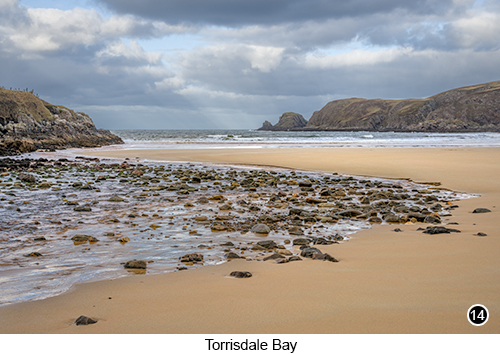 |
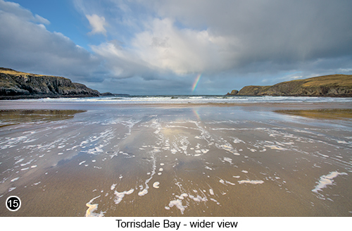
Torrisdale Bay is small, but beautiful and if you are here outside of the main tourist season, you will probably have the place to yourself. It is also a shallow bay, where even relatively small waves, still travel a long way up the beach, leaving streaks of foam as they retreat, as shown in SHOT 15 below. So wide angle shots of wet, reflective, foam flecked sand, is probably going to be part of your composition. So make sure you have your wide angle lens with you, as you are definitely going to want to use it here. As a matter of historical interest, if you walk into the centre of Torrisdale Beach and look up at the grassy hill behind you. You will see a large boulder sat in the middle of a field. Which is referred to in Scottish folklore, as the "Ring stone". Where it is said that two giants had a furious disagreement, before trying to kill each other. With the Naver Giant at the bottom of the hill and the Aird Giant at the top. Who started to argue, about who owned all of the sheep grazing in the field, where the Ring stone now stands. |
|
 |
With the argument quickly getting out of hand, as they started to hurl this huge boulder at each other, in an attempt to knock each others heads off. But after hurling the boulder back and forth several times and missing. The Naver giant at the bottom of the hill, began to run out of energy, due to him having to throw the boulder uphill. With his last throw, landing only half way up the hill. The Aird giant at the top of the hill seeing this, started to take pity on the Naver Giant and called down to him to offer him a solution. Where he suggested to the Naver giant, if you give me your gold ring, I will let you keep all of the sheep. To which the Aird giant flatly refused, but instead took off his gold ring, walked up to the boulder and placed the ring on the ground beside it. Before picking up the boulder one last time and wedging it down hard, over the top of the ring. The Aird giant then climbed on top of the boulder to sit on it. As a way to make sure the Naver giant couldn't take it. ...and where it is said, the Aird giant's gold ring still lays to this day. Because no one has ever been strong enough, to lift up the boulder and retrieve it. Which is how this large nondescript boulder, sat in the middle of a field next to Torrisdale Bay, became known throughout Scotland as the "Ring stone". |
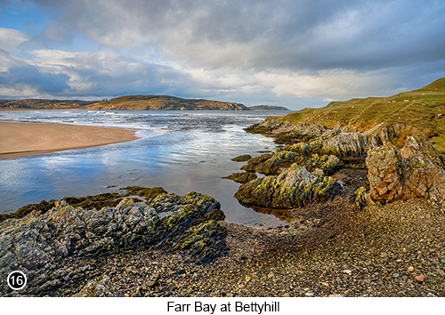
Farr Bay at Bettyhill: Bettyhill, or in Scottish Gaelic "Am Blàran Odhar" is a tiny village, located high up, on the Northern most coast of mainland Scotland. And, as with most tiny coastal villages in this remote region. Owes its existence, to the once thriving Atlantic coastal fishing industry. Where Bettyhill and Farr Bay in particular, became famous for its large, annual, wild Atlantic Salmon harvest. Where a net would be hung across the mouth of the river Naver, (the mouth of the River Naver, is shown in SHOTS 16, 17 and 18 below), in what used to be called "Sweep Net Fishing" or "Net and Cobble Fishing". Which at the peak of its use in 1962 and using only a three man team. Could expect to land upwards, of 1,000 fully grown Atlantic Salmon per day. Just from this small stretch of the River Naver alone, as shown in SHOT 16 below. |
|
Yet as with all things, where the hand of man and greed are involved. After hitting this 1,000 catch per day peak in 1962, the Salmon stocks on the River Naver, began to decline dramatically. Which continued on, until in 1992, the numbers of wild Atlantic Salmon that were being caught here, had dwindled so low, that the expected catch, might only be one or two Salmon per day, if they were lucky! Which finally forced the Scottish government to step in and ban the act, of commercial coastal net fishing altogether. Totally wiping out the practice and what remained of the industry overnight. But which did at least allow the Salmon, to slowly begin to restock the river Naver once again. Albeit in much lower numbers than before. So if while you are here, you fancied a few hours fishing, for wild Atlantic Salmon on the river Naver? You are now required by law (with stiff penalties for those who don't comply), to first apply for and then be granted, a very expensive government license. But which are rarely given out and even if you were lucky enough to get one. Place very strict limits, on the size and number of wild Salmon, that can be caught today. Now back in your vehicle, after exploring and photographing Torrisdale Bay. If you then turn immediately right, out of the unofficial Torrisdale Bay parking area. You will see a narrow, single track road, called "Aird Neiskich", that passes by the Bettyhill Church of Scotland, a little further up the hill, Street View, Map View. |
 |
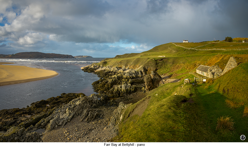
Drive all the way up to the end, of the single track Aird Neiskich road. Where you will then arrive at a stunning, yet little known view, of what remains of Bettyhill Harbour and a couple of old, ruined, fish processing buildings on the right. As shown in SHOT 17 below, Street View, Map View. Here you will find magnificent, untouched views, along the side of the River Naver and then out to the sea in the near distance. With a golden sand beach on the other side of the river, that I don't think anyone ever walks on. I mean just look at the view shown in SHOT 17 below and tell me, this place doesn't look absolutely amazing? In fact have you ever seen anywhere else that looks like this? Because to me, the words "stunning" and "beautiful", just don't seem to do this place justice. |
|
 |
|
So park wherever you can and set up your camera, on the grassy area next to your vehicle, near to the sticker covered sign. For magnificent views, in almost every direction. Tip: look for and shoot, the low angled sidelight, you will find at this location in early winter, through to early spring. As it will really help to make your images pop, if you can incorporate this type of moody, contrasty, side lit detail into your shots, as shown above. This is yet another fantastic place, for spending a couple of peaceful hours, wandering around with your camera. Having a picnic and bird watching, as you listen to the sound of the sea. In fact if you don't own a flask before you come here, then I strongly advise that you to buy one, before you set off. Because it just doesn't get any better than this. Sitting here with a hot cup of tea or coffee, a freshly made sandwich and cream bun, as you watch the birds fly by and just soaking up the atmosphere. TRULY AMAZING!!! |
|
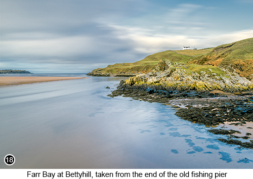 |
If you then look behind you, you will see what remains of the old fishing pier. Which is where they used to haul in their sweep nets. But which is now starting to crumble with age. Yet still looked strong enough, for me to walk out to the end of. To set up and take, a long exposure shot of the scene, as shown here in SHOT 18 to the left. But you have to be extremely careful here. Because not only is the old pier showing its age, with significant signs of decay. But the River Naver at this choke point, is very deep and fast flowing. Due to such a large amount of water, having to flow in and out through this tiny gap, during each tide. Which creates dangerous undercurrents. So no swimming and no letting your dog jump into the water, if you have one. As you will probably never see it again if you do... Skerray Harbour and Pier: is a tiny and forgotten little harbour, that once used to thrive as a Herring fish landing port. Where dozens of boats, would unload their cargos every day. But which is now no longer used, due again to the depletion of stocks and the introduction of coastal wildlife conservation laws. In fact it is rare, to see any fishing boats moored in Skerry Harbour these days. It is thought the name "Skerry" or "Skerray", is derived from an ancient Norse word, meaning an area between the rocks and the seashore. Or more commonly, a group of rocks, that protrude out just above the waves, even at high tide. |
Having now photographed the River Naver viewpoint, at Bettyhill. If you return to your vehicle and drive out the way you came in and back onto the main A836 road. Where you will then turn immediately right, heading further West, Street View, Map View. You will then drive through several more tiny settlements, of Achina, Invernaver (with a large, recently upgraded bridge), Leckfurin, Achnabourin etc. Until you see a right turn, along a single track road named Clashbuie. Which will take you all the way down to Skerray Harbour, 4 miles further on. So turn right here, Street View, Map View. |
|
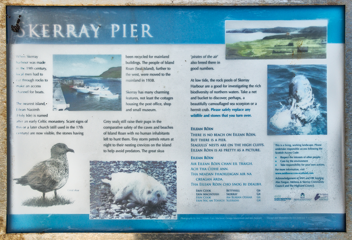
Then continue on for 4 miles, to the end of the Clashbuie road. Until you arrive at the old Skerray Pier. Where you will find several places to park, next to an old building on your right, overlooking Skerray Bay to your front, Street View, Map View. You will then see an old, weather beaten information board for the Skerray Pier. As shown below. |
 |
 Click on the image above, for a larger view. |
|
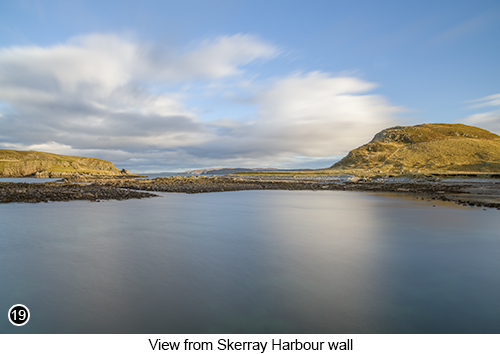
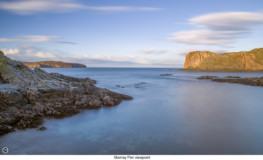
I then walked down to the end of the old stone pier, that you should now see to your front left. Where I then took a shot of the view back up the coast to my right, as shown in SHOT 19 above. Before climbing up onto the top of the harbour wall itself, to capture this long exposure pano, of the scene in front of me, as shown in SHOT 20 below. But what doesn't show up, in this long exposure shot shown below. Is the large number of Gannets and gulls, that kept flying over my head as I took this shot. Towards what I think must have been some type of a "Bait Ball" feeding frenzy, taking place just a little further out into the sea. But behind the cliff to my front left. But whatever it was, the birds were all rushing towards? There certainly was a lot of them. In fact, it is worth keeping an eye out for this type of "Bait Ball" feeding frenzy phenomenon. Where you will see lots of Gannets, plunging beak first into the sea, like large, accelerating darts. As they attack the bait ball from every side, until it is gone. |
|
 |
|
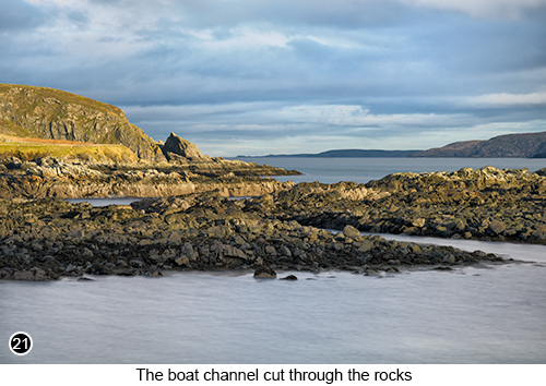
I then came down from the harbour wall and walked around to the right, to the end of the old pier. Where I set up to shoot, the best view I could of the old "Cut Through Access Channel" into the harbour and across to where I had just been shooting back at Bettyhill, as shown in SHOT 21 below left . The "Cut Through Access Channel", seen in the image below left . Was how fishing boats used to navigate their way into Skerray harbour. Because even though the local fishermen, desperately wanted to build an harbour at this site, near to their homes. There was no easy way to sail into the bay, without colliding with one of the numerous "Skerries" that blocked the Bay entrance. So they all got together, to dig out a channel for themselves, to create a deep, narrow, navigatable route, that cuts through this part of the Skerry. Which would then allow them to sail, all the way into the harbour at high tide. But only if you knew where this channel was, below the water. |
|
 |
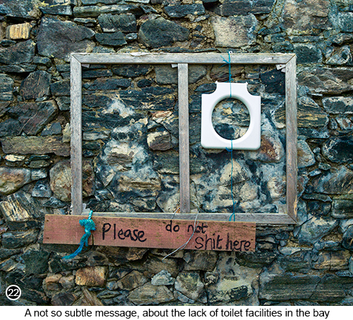 |
I then went for a wander with my camera, taking handheld shots of the old building and the various bits of discarded, rotting boat hulls that were around it. As well as whatever remained of any fishing equipment etc. Until I eventually wandered into the old, ruined stone building, that we were parked next to. Just scouting around to see, if there was anything worth shooting in there. When I stumbled across this 'not so subtle message' from one of the locals, hanging on the wall, as shown above in SHOT 21. That informs visitors, in no uncertain terms. They should not even begin to think about doing, what some other inconsiderate visitor, had obviously done here before. Which at first took me by surprise, then break out in uncontrolled laughter. Which I knew I had to photograph, if for no other reason, than just to show you guys... |
|
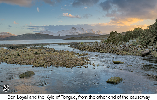
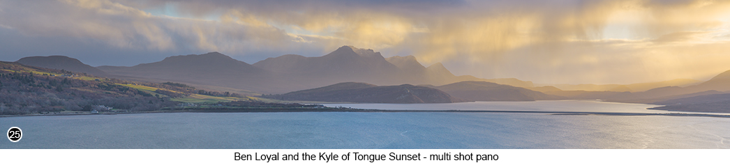
The Kyle of Tongue and the Ben Loyal Mountains: then having photographed your way around Skerray Harbour. We are now going to carry on further West, along the main A836 road, then across to the Kyle of Tongue and the Ben Loyal mountains. Where you will find yet more magnificent views to photograph. As shown here in SHOT 23 to the right and SHOTS 24 and 25 below. So once again, retrace your steps back out from this location, to the main A836 road and turn right. As you now continue driving further West, towards the tiny village of Modary, Street View, Map View. Continue driving West on the A836 road (which then joins the A838) for another 3 miles, Street View, Map View. Then on through the village of Modary, heading further West, towards the coastal village of Tongue. Then once through the village of Tongue, you will come out onto a long causeway, that crosses the Kyle of Tongue, as can be seen in SHOT 25 below. The Scottish word "Kyle", means mouth, as in the mouth of a river. So technically speaking, you could say this is the Mouth of Tongue..! Tip: the village of Tongue, has a small, but well stocked grocery store and Post Office, in the centre of the village. So if you need to top up your supplies, then do so here.Then once you drive out onto the causeway and about one third of the way across it. |
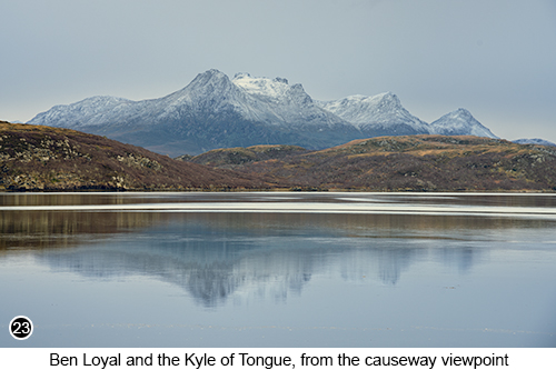 |
You will see a large official car parking area on your left, Street View, Map View. So pull in here and park wherever you can. Now even though this is an official car park and viewpoint. The car park itself, is totally unmaintained and has a lot of deep, water filled potholes within it. That after rain and at first glance, can look like shallow puddles, that would be easy to drive across, but most of them are not. So take your time, weaving your way around the many potholes and puddles you will find here, as they are deep and sharp edged. Which I can tell you, after visiting this viewpoint, many times over the years. These repairs have never been done, or even attempted, so probably never will. But anyway, you should now see the view in front of you, as shown in SHOT 23 above. So park wherever you can, at the farthest edge of the car park nearest to the sea and setup you camera there, or further down on the beach. |
|
 |
Tip: the best time to be here, is at the highest point of the tide. As the Kyle of Tongue Bay, drains out almost completely when the tide is out and just doesn't look as good to photograph in my humble opinion. Also a calm and windless day will help, if you want to shoot reflections, like that shown above in SHOT 23. The Ben Loyal mountain range, which is spelt in Scottish Gaelic as "Beinne Laghail", meaning "Law Mountain". Is just over 2,500 feet tall at its highest point, with the peak itself called "An Caisteal". There is also what looks like, a large gouge out of the top of An Caisteal. Which is referred to locally as "The Boar's Scratch", as can be seen in the centre of SHOT 25 below . Where it is said in Scottish folklore, that the Boar's Scratch, was created by a giant wild boar. That had huge, razor sharp tusks and poison tipped bristles all over its body. That had one day appeared out of nowhere. But which was now terrorising the Kyle of Tongue community, leaving a wide path of death and destruction in its wake. That is until a warrior called Fingalian, heard about the giant boar and decided, that as his sweat heart and soon to be wife, lived in the Kyle of Tongue area. He would have to do something about it, if he wanted to keep her safe. So he tracked down the monster and immediately engaged it in battle, by attacking the boar from behind with his sword. |
The boar feeling the sting of being stabbed in the rear, turned around and lunged back at Fingalian, with its massive, razor sharp tusks. But which Fingalian managed to sidestep, as the boar's tusk swept past his head and dug deep into the mountain, gouging out a large chunk of rock. Which then became known to the locals, as the "Boar's Scratch". The battle continued like this for several hours. Until the giant boar began to grow weak, with each thrust of Fingalian's sword, causing it to lose more blood. Until the boar finally dropped dead and rolled down the back of the mountain. Fingalian was so overjoyed by his victory and how he had been able, to single handedly kill the beast and protect his girlfriend. He wanted to tell everyone in the village what he had done and how huge the giant boar was he'd just killed. So he decided to measure the beast from tusk tip to tail, before going back to the village, to break the good news. |
|
 |
|
So Fingalian ran down the side of the mountain and jumped up onto the back of the lifeless boar. Removed his shoes and began to pace along the back of the beast, counting how many toe to heel footsteps, it took him to walk the full length of its body ...and that's when he stepped, onto one of the boar's poison tipped bristles. Almost immediately, Fingalian's feet began to itch and burn. Then within an hour, he started to feel light headed and then before nightfall, he was dead! The locals hearing about this epic battle, then walked up to the base of the mountain the following day, to see what had happened. Where they found Fingalian and the boar, lying dead next to each other. So as respect for the great battle that had taken place between them. They buried them both side by side, at the foot of Ben Loyal. |
|
|
|
After taking your shots of Ben Loyal, from the official Kyle of Tongue viewpoint car park. If you carry on driving, over to the opposite end of the causeway. You will see another parking area on your left, Street View, Map View. Where a small, but fast flowing burn, runs into the sea, as shown in SHOT 24 above. So park here and walk down to the edge of the burn to take your shots. However, there is an ugly building you will see creeping into the right of your frame. But which I found easy to obscure, by moving my tripod to the right, so I could hide it behind some bushes. I then drove to the next location and to what I believe to be, the best photographic viewpoint, of the Kyle of Tongue and the Ben Loyal mountain, as shown in SHOT 25 above. |
|
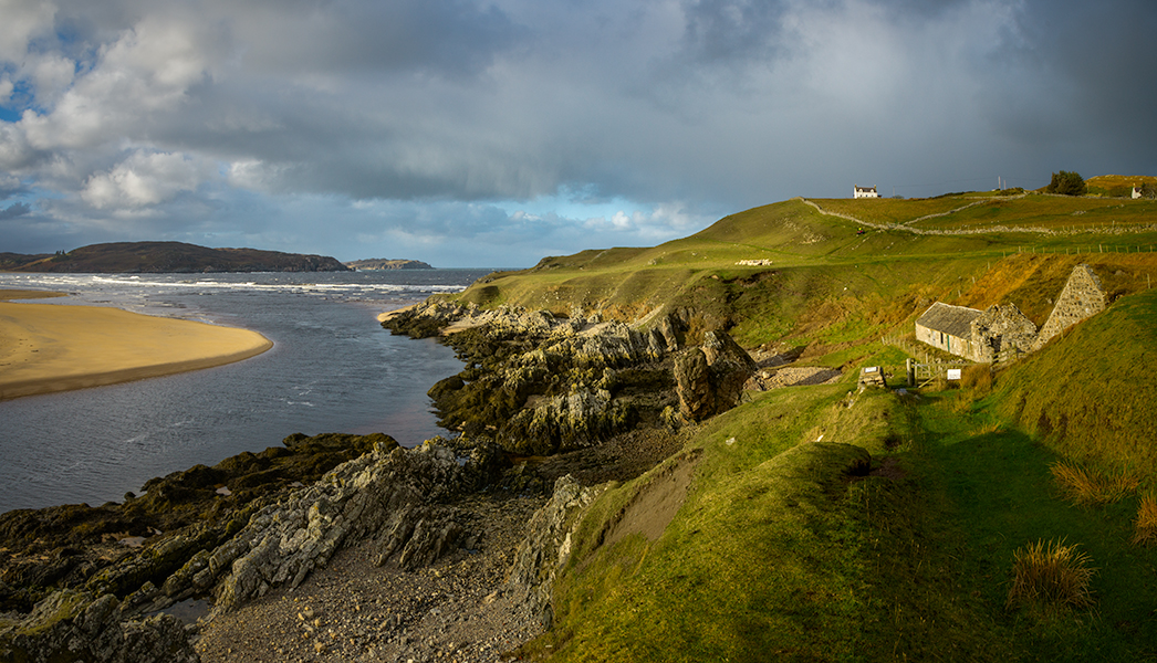
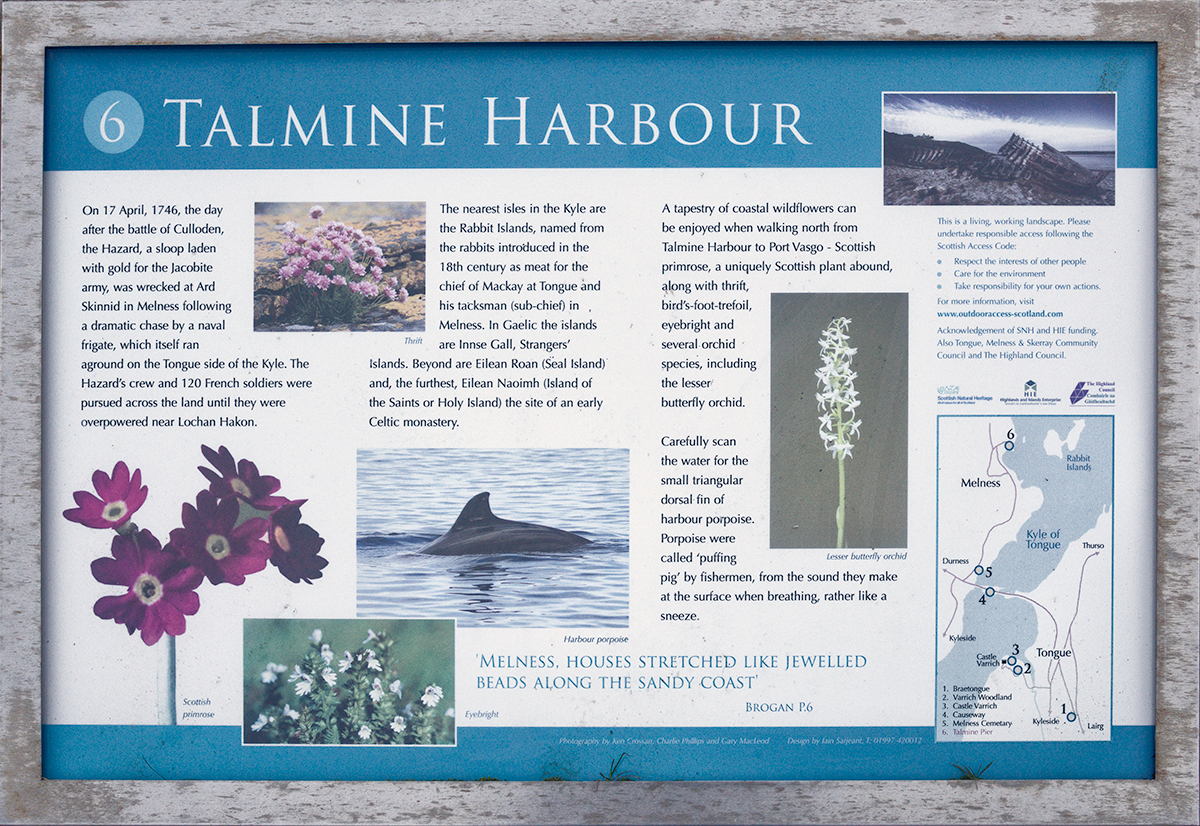
Talmine Harbour Bay: from the far end of the Kyle of Tongue causeway parking area. You will see, on the other side of the main A838 road. There is a single track, unnamed road, signposted for the village of Melness. With the tiny fishing harbour of Talmine, five miles further on, Street View, Map View. So drive across the A838 and onto this unnamed road and continue driving, on towards the village of Melness. Then about a mile along this unnamed road, you will come to another official parking area on your right. With an even better view of the Kyle of Tongue and the Ben Loyal mountain range in the background, Street View, Map View. So park here and walk out to the edge of the car park, as near to the fence as you can. Where you will then have the opportunity, to capture the entire vista before you, as a multi shot pano. Which I had to shoot handheld, as the light was changing so fast, I barely had time to grab the many shots it took, to make up this super wide pano. Before the sunset sidelight, had faded away completely. Then having taken your version of this panoramic view, shown in SHOT 25 above. If you now get back into your vehicle and continue driving along this unnamed road, for another four miles. Until you arrive at a very narrow "Y" junction in the road. With a view out to the sea and the old harbour wall in front of you and Talmine Bay, sweeping around to your right. |
 |
|
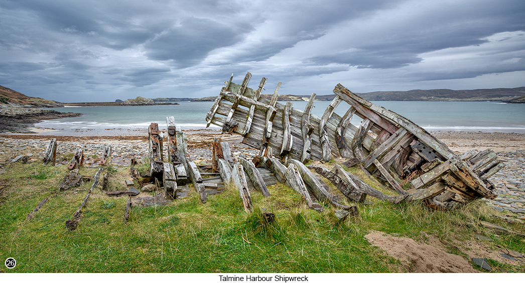
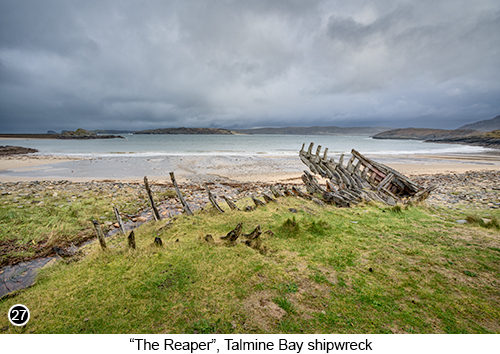
Take the right hand fork from the "Y" junction and continue down into Talmine Bay, now less than a mile ahead, Street View, Map View. Once down the hill and heading towards the old harbour wall, that you should now see in the distance. Keep going until you see, a small two space parking area on your right, that overlooks the bay and park here, Street View, Map View. You should now be able to see, a hundred yards or so directly to your left. What remains of an old wooden shipwreck, of a boat called "The Reaper", as shown in SHOT 26 above and SHOT 27 above right. So grab your camera and wide angle lens and walk down the road, towards the old shipwreck, to find your best composition of the scene, from the grassy knoll it sits on. |
"The Reaper" was built in 1948 and originally used, as a North Sea fishing vessel called "Selina". Before being bought in 1974 by a new owner, who renamed her "The Reaper" and who intended to fully refurbish her and put her back, into her original condition. But unfortunately, during her extensive refurbishment in 1976, she accidentally caught fire and the upper deck was significantly damaged. Then shortly thereafter, with the boat still in dry dock and the owner trying to decide, whether to continue with her refurbishment. He suddenly took ill and then quickly passed away. Which meant the dry dock owners, were no longer getting paid for their service. So they towed the wreck across to Talmine Bay, where she was run aground and left to slowly rot away. |
|
 |
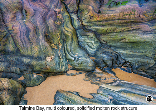 |
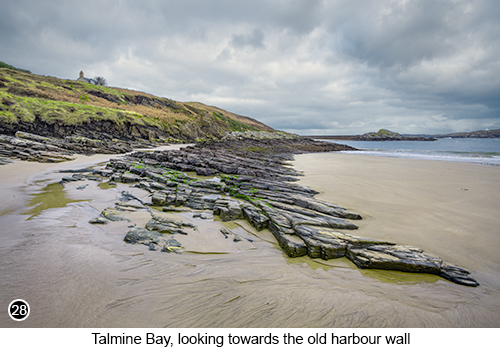
You will then see, just behind the old shipwreck and the small burn (stream), that runs out onto the beach. Where at low tide, there is a long, sweeping line of broken rocks, that curves very nicely across the image and pulls the viewers eye into the scene, as shown in SHOT 28 above left. Tip: I have heard of compositional elements like this, being referred to as "C" curves and how they are always worth incorporating into your shot, if ever you see one. So think of SHOT 28, as an example of this idea and how it works. If you then walk back to the other end of Talmine Bay at low tide. You will find a group of large rocks and boulders, that at first glance, don't look too be very photographically interesting. But if you get in close and look behind the first set of rocks. You will find an area, with lots of interesting shapes, patterns and colours to shoot, as shown in SHOT 29 above right. So if you have a close-up lens with you (Macro), or a longer lens that will allow you to zoom into the detail. Then this would be a good time to use it. |
|
 |
|
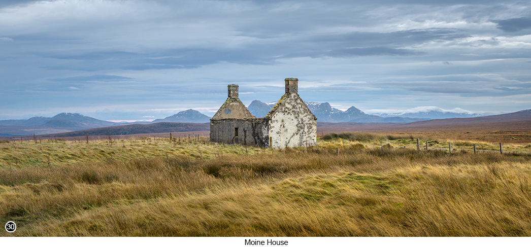
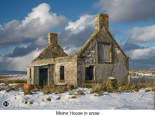
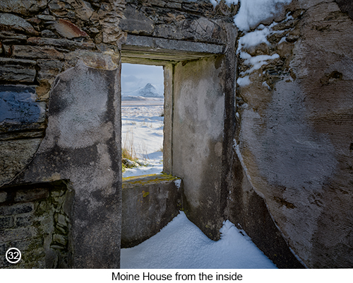
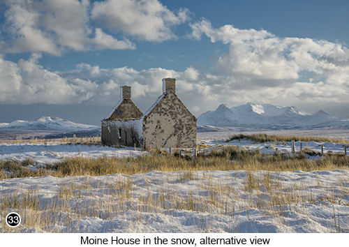
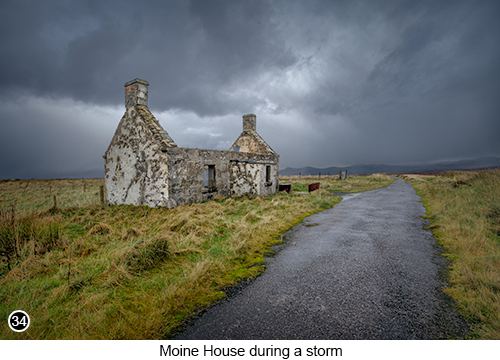
Moine House: From Talmine Harbour, retrace your steps back onto the A838 and turn right, before continuing West up the hill, for another 11 miles, Street View, Map View. Until you come to a sharp left hand turn, into the official and well maintained, Moine House Car park, Street View, Map View and park wherever you can here. I have already covered the "Moine House" location, in a previous free photo guide chapter, which you can read HERE if you so wish. But which I think is a location, that is worth showing you again anyway. As this is old ruined house, is just such an amazing subject to photograph. And no matter how many times I visit here, I always seem to walk away, with a least one good shot. But which on my last visit to Moine House, I walked away with several, as shown in SHOT 30 above and SHOTS 31, 32, 33 and 34 below. . |
|
 |
 |
So I do highly recommend, that you visit Moine House to photograph it, as I know you will not be disappointed. No matter what the weather conditions are, or what time of day it is. Or even what season of the year it is. Because I am sure, you will be able to create something worthwhile here. In fact I can almost guarantee it. Tip: Try to be here at Moine House, as early in the morning as you can, especially if it has snowed the night before. As this location does attract passing NC500 tourists (NC500 is a well known camper van tourist route, around the North of Scotland). So even though most of the people, who drive up to this location in their campers, have little idea this old house is on their route. Will spot it on the horizon and decide, it is probably a good place to stop to stretch their legs and empty the dog. Which means, it can get quite busy at Moine House in the middle of the day. So try to avoid this time and plan to stay here photographing, for at least two hours, if not more. |
|
 |
 |
If you intend to visit every location I have described, in both part 1 and 2, of this free photographer's guide, to the Northern regions of mainland Scotland - and why wouldn't you? Then you really should allow yourself, at least one full week to complete this route. If you want to get the most, out of all the photographic possibilities you will find here. In fact we always come up to this area of Scotland, for at least two separate weeks each year. One in late spring and one in late autumn/early winter. Because we know from experience, there will always be something new for us to see and for me to photograph. As it really is that good and always seems to deliver the goods without fail. So who knows, we might even see you up there, the next time we visit..? |
|
--Exif information for each of the numbered shots shown throughout this chapter <--- The reason why the dates shown below, appear to span over several weeks, is because I visited these locations at slightly different times over the years ---> --13 - Sigma 150-600mm F5-6.3 DG OS HSM | Sports, 1/1250 Sec, f/6.3, ISO 250, Focal Length 600mm, taken on 10th Jun at 13:38 --15 - Canon EF16-35 f/2.8L USM, 1/125 Sec (-/+ 2 stop bracket), f/16, ISO 100, Focal Length 16mm, taken on 16th Nov at 11:12 --17 - Canon EF16-35 f/2.8L USM, 1/125 Sec, f/13, ISO 100, Focal Length 16mm (cropped into a pano), taken on 16th Nov at 16:13 --20 - Sigma 24-105mm F4 DG OS HSM | Art, 30 Sec (with 10 stop ND), f/16, ISO 50, Focal Length 24mm, taken on 22nd Mar at 10:14 - 21 - Sigma 24-105mm F4 DG OS HSM | Art, 4 Sec (with 3 stop ND), f/16, ISO 50, Focal Length 105mm, taken on 22nd Mar at 10:56 --23 - Sigma 150-600mm F5-6.3 DG OS HSM | Sports 014, 1/20 Sec, f/8, ISO 50, Focal Length 95mm, taken on 18th Nov at 10:05 --25 - Sigma 24-105mm F4 DG OS HSM | Art, 1/200 Sec, f/8, ISO 200, Focal Length 105mm (handheld 7 shot pano cropped), taken on 16th Nov at 15:08 --27 - Canon EF16-35 f/2.8L USM, 1/125 Sec (-/+ 2 stop bracket), f/16, ISO 100, Focal Length 16mm, taken on 16th Nov at 14:48 --29 - Sigma 24-105mm F4 DG OS HSM | Art, 1/100 Sec, f/16, ISO 50, Focal Length 64mm, taken on 15th Nov at 13:11 --32 - Canon EF16-35 f/2.8L USM, 1/50 Sec (-/+ 2 stop bracket), f/13, ISO 100, Focal Length 29mm, taken on 20th Nov at 10:51 - 33 - Sigma 24-105mm F4 DG OS HSM | Art, 1/200 Sec, f/14, ISO 100, Focal Length 51mm, taken on 20th Nov at 11:12 |
|
If you have enjoyed reading these 'Extra' chapters to my Guide Book and think you might also enjoy reading 79 more chapters across 270 pages, that also includes more than 340 Fine Art quality images, along with detailed descriptions and large scale maps to guide you to the exact location of where I took each and every one of them and which then goes onto discuss the techniques and tools I used to process them, but where everything is written in plain easy to understand English? Then please consider buying the Book. |
 |
 |
|